Projects & Publications
NUVit covers several case studies, projects and living labaratories.
VitalNodes (2017-2019, EC, Horizon 2020). For more information: https://vitalnodes.eu/
CEDR – Transnational Research Programm – FluxNet
Research Call CEDR: Freight and Logistics in a Multimodal Context: How can NRAs influence modal choice of freight transport?
Part B: How can infrastructure and infrastructure services affect modal choice
Study FLUXNET: concept toolbox for logistics oriented development
In order to gain more insights on the interlinkages between spatial demands, logistics and Infrastructure Conference of European Directors of Roads (CEDR) has initiated a study into these interlinkages: FLUXNET – Freight and Logistics Using eXtended Network Empowerment Tools. The objective of the FLUXNET research project is to provide insight in the tools for planning professionals – such as NRAs, regional planning bodies and municipalities – that help optimizing the multi-modal use of the infrastructure networks by the transport and logistic sector. Special attention has been paid to the connection between land use and infrastructure planning. This will help to further explore the potential benefits of integrating multimodal transport networks, liveability and spatial planning. The methodology used in the research consists of three phases. The first phase aims at constructing a preliminary toolbox. An analysis of trends in logistics and freight transport is conducted. In the second phase, a global scan of approximately 25 good practices is carried out. Abstractions of the tools and strategies that can be derived from the good practices have resulted in the draft for the preliminary toolbox. The third phase consists of a series of four test beds across Europe to have a first expert judgment on the preliminary toolbox. Together with local and regional experts, issues in the field of logistics, transport and land use have been investigated by applying the preliminary toolbox. The result of this phase is a sharpening of the toolbox.
RUG –
Linking the economic regions in Europe: a first draft of how the TEN-T corridors support the economic interaction of various metropolitan regions in Europe with the objective to derive spatial-economic indicators. The aim of this project is to enable a shared understanding among strategic public and private stakeholders of the relationship between transport connectivity, regional competitiveness, quality of life at the European level. The objective is to support these discussions with a reference base that is transparent and fact based (from established sources such EUROSTAT, OECD, …) as well as easy to use as a communication tool e.g. in workshops and seminars feeding into this discussion. The project has two stages. The first stage will work on a selection of key indicators which establish top 30 economic areas and its relation with the major infrastructure axes (TEN-T) and it only presents results in hardcopy and animated pdf format. The first results will be shown on TRA 201 and TEN-T 2018.
The second stage will aim to realize a transparent reference base in an online digital dashboard format; a format which allows interactivity of the uses in studying and handling the maps. This stage aims to explain and present the key elements of the complex relationship between infrastructure and spatial economy on the basis of a limited but carefully chosen set of key data that allow a deeper and shared understanding.
Collaborative planning:
The Conference of the European Directors of Roads (CEDR) is starting the Research Call Collaborative Planning of Infrastructure and Spatial planning and starts from the road network because of its versatility: comprising both freight as well as passengers transport, being an essential element of multi-modal mobility, and providing transportation at both the local, urban-regional and (inter)national level. When responding to changes in mobility and infrastructure, it is vital that National Road Authorities (NRAs) reduce the environmental impact as much as possible. Also, NRAs need to enhance the added value of infrastructure for society by developing and managing infrastructure that increases the economic competitiveness, sustainability, liveability and spatial quality of (peri-urban) regions. This joint multi-modal infrastructure and spatial planning requires careful collaboration between NRAs, other transport authorities and planning administrations at different levels of scale as well as cooperation with market parties and stakeholders (‘multi-level governance’). The central question is how to achieve integrated project development of infrastructure and its spatial surroundings? The Research call focuses on the need for developing a common framework to obtain the synergies from interactive planning of infrastructure and spatial development (‘collaborative planning’).
The aim is to produce synergies that result in a higher return on investments relating to:
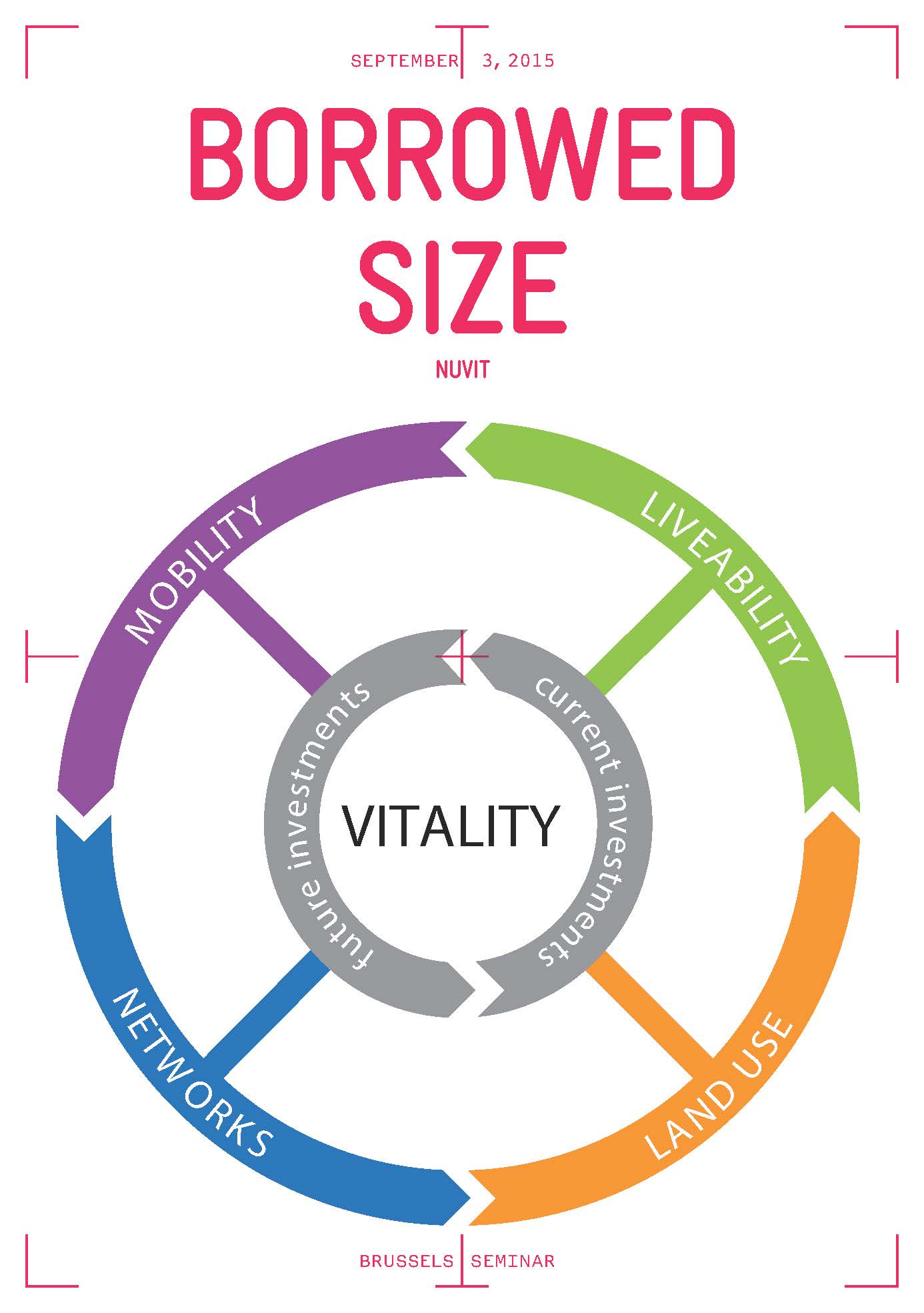
Borrowed size
Borrowed size is a new kid on the block in the agglomeration literature, and it looks at agglomeration in a regional network perspective. It suggests that several medium-sized cities in each other’s vicinity may function as a larger metropolitan region by borrowing each other’s functions. Many highly productive urban regions in the EU are indeed small- to medium-sized whose dominant competitive advantage is that they exhibit high degrees of connectivity compared to urban or home market scales. The Dutch, Belgian and German Lower Rhineland regions actually are prime examples of such urban scales. In terms of economic growth good connected medium-sized cities can function as one large city, and hence can also benefit from an agglomeration premium. But this is conditional on the quality of physical connectivity, local amenities and the housing markets.
Source: Synergies between metropolitan, agglomeration, infrastructure and network policies in urban Europe: The case of the Lower Rhine Region
Prof. dr. Henri L.F. de Groot, Prof. dr. Frank G. van Oort & dr. Martijn J. Smit
Vrije Universiteit Amsterdam, Erasmus University Rotterdam and Utrecht University
CEDR – Transnational Research Programm – FluxNet
Research Call CEDR: Freight and Logistics in a Multimodal Context: How can NRAs influence modal choice of freight transport?
Part B: How can infrastructure and infrastructure services affect modal choice
Study FLUXNET: concept toolbox for logistics oriented development
In order to gain more insights on the interlinkages between spatial demands, logistics and Infrastructure Conference of European Directors of Roads (CEDR) has initiated a study into these interlinkages: FLUXNET – Freight and Logistics Using eXtended Network Empowerment Tools. The objective of the FLUXNET research project is to provide insight in the tools for planning professionals – such as NRAs, regional planning bodies and municipalities – that help optimizing the multi-modal use of the infrastructure networks by the transport and logistic sector. Special attention has been paid to the connection between land use and infrastructure planning. This will help to further explore the potential benefits of integrating multimodal transport networks, liveability and spatial planning. The methodology used in the research consists of three phases. The first phase aims at constructing a preliminary toolbox. An analysis of trends in logistics and freight transport is conducted. In the second phase, a global scan of approximately 25 good practices is carried out. Abstractions of the tools and strategies that can be derived from the good practices have resulted in the draft for the preliminary toolbox. The third phase consists of a series of four test beds across Europe to have a first expert judgment on the preliminary toolbox. Together with local and regional experts, issues in the field of logistics, transport and land use have been investigated by applying the preliminary toolbox. The result of this phase is a sharpening of the toolbox.
RUG –
Linking the economic regions in Europe: a first draft of how the TEN-T corridors support the economic interaction of various metropolitan regions in Europe with the objective to derive spatial-economic indicators. The aim of this project is to enable a shared understanding among strategic public and private stakeholders of the relationship between transport connectivity, regional competitiveness, quality of life at the European level. The objective is to support these discussions with a reference base that is transparent and fact based (from established sources such EUROSTAT, OECD, …) as well as easy to use as a communication tool e.g. in workshops and seminars feeding into this discussion. The project has two stages. The first stage will work on a selection of key indicators which establish top 30 economic areas and its relation with the major infrastructure axes (TEN-T) and it only presents results in hardcopy and animated pdf format. The first results will be shown on TRA 201 and TEN-T 2018.
The second stage will aim to realize a transparent reference base in an online digital dashboard format; a format which allows interactivity of the uses in studying and handling the maps. This stage aims to explain and present the key elements of the complex relationship between infrastructure and spatial economy on the basis of a limited but carefully chosen set of key data that allow a deeper and shared understanding.
Collaborative planning:
The Conference of the European Directors of Roads (CEDR) is starting the Research Call Collaborative Planning of Infrastructure and Spatial planning and starts from the road network because of its versatility: comprising both freight as well as passengers transport, being an essential element of multi-modal mobility, and providing transportation at both the local, urban-regional and (inter)national level. When responding to changes in mobility and infrastructure, it is vital that National Road Authorities (NRAs) reduce the environmental impact as much as possible. Also, NRAs need to enhance the added value of infrastructure for society by developing and managing infrastructure that increases the economic competitiveness, sustainability, liveability and spatial quality of (peri-urban) regions. This joint multi-modal infrastructure and spatial planning requires careful collaboration between NRAs, other transport authorities and planning administrations at different levels of scale as well as cooperation with market parties and stakeholders (‘multi-level governance’). The central question is how to achieve integrated project development of infrastructure and its spatial surroundings? The Research call focuses on the need for developing a common framework to obtain the synergies from interactive planning of infrastructure and spatial development (‘collaborative planning’).
The aim is to produce synergies that result in a higher return on investments relating to:
- More robust multi-modal accessibility
- Added value to spatial-economic development
- Improved sustainability and liveability
- Enhanced societal support
- Reduced costs of mitigation and planning time, and
- Diversification of financing sources (co-funding by other authorities and infra users).
Borrowed size
Borrowed size is a new kid on the block in the agglomeration literature, and it looks at agglomeration in a regional network perspective. It suggests that several medium-sized cities in each other’s vicinity may function as a larger metropolitan region by borrowing each other’s functions. Many highly productive urban regions in the EU are indeed small- to medium-sized whose dominant competitive advantage is that they exhibit high degrees of connectivity compared to urban or home market scales. The Dutch, Belgian and German Lower Rhineland regions actually are prime examples of such urban scales. In terms of economic growth good connected medium-sized cities can function as one large city, and hence can also benefit from an agglomeration premium. But this is conditional on the quality of physical connectivity, local amenities and the housing markets.
Source: Synergies between metropolitan, agglomeration, infrastructure and network policies in urban Europe: The case of the Lower Rhine Region
Prof. dr. Henri L.F. de Groot, Prof. dr. Frank G. van Oort & dr. Martijn J. Smit
Vrije Universiteit Amsterdam, Erasmus University Rotterdam and Utrecht University
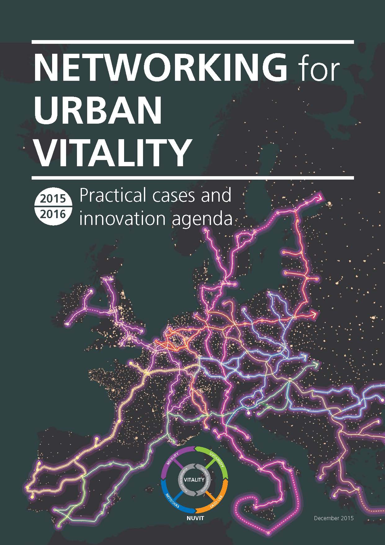
Networking for Urban Vitality (NUVit) is an initiative which originates from the ‘Transport Infrastructure Integrated with Land Use’ (TIILUP) roadmap (FEHRL), the Rotterdam2Ruhr scoping study (Rijkswaterstaat, the Netherlands) and the Healthy Urbanization publication (Ministry of Infrastructure & the Environment, the Netherlands). NUVit is guided by an international core group of experts (infra-providers, authorities, knowledge institutes and consultants – see appendix) and is a platform in which knowledge concerning NUVit (Mobility, infrastructure networks, liveability and land use) is exchanged and embedded in practice.
